LAKESHORE ROAD WEST:
A Multi-Year Battle to Preserve a Scenic Corridor
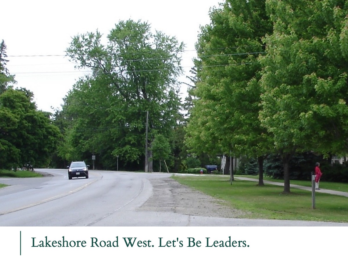
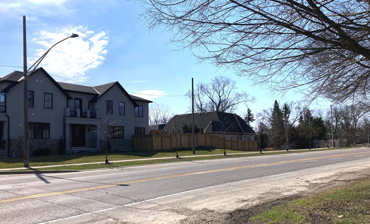
A Part of Oakville's History
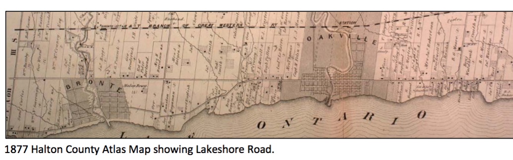
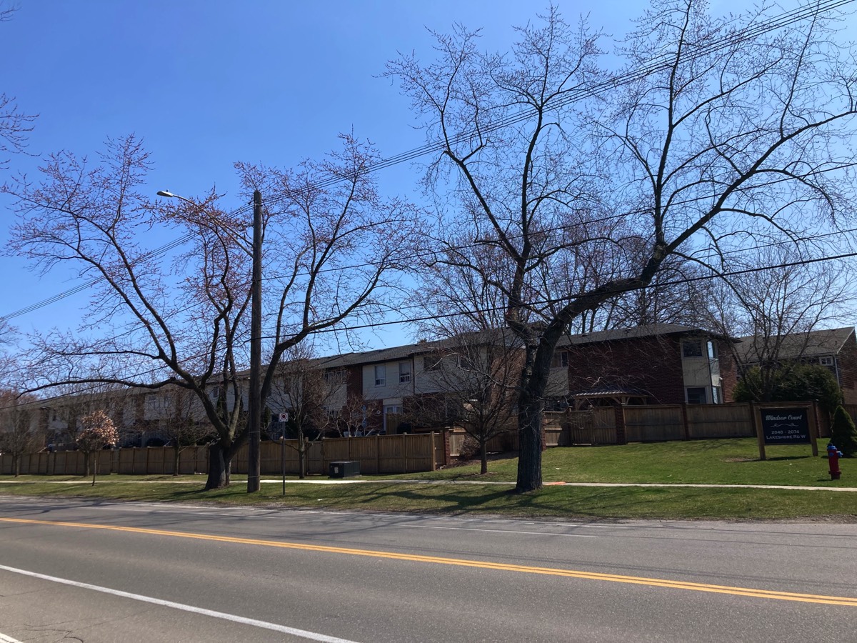
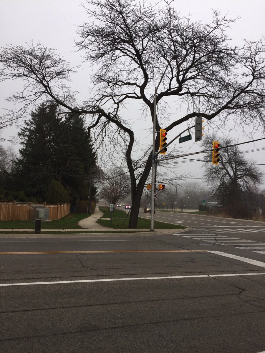
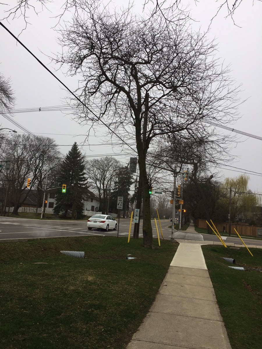
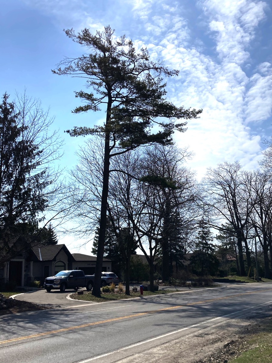
The second section from Fourth Line to Winston Churchill Boulevard follows a straight east- west concession road, originally laid out as part of the 1806 Wilmot Survey.
The origins of these two sections of Lakeshore Road still define much of their character and arrangement today. As well, Lakeshore Road was one of the original Kings Highways introduced in 1917.
What's the Big Deal?
The urbanization was to include the widening of the road to accommodate a continuous centre turn lane, the addition of a 3-m wide asphalt Multi-Use Path, the cutting down over 300 trees, the expropriation of land from dozens of home owners, the addition of curbs and gutters along the route, bike lanes and adjustments to intersections.
We got to work and did our homework.
In traffic reports, we discovered that the entire Lakeshore corridor is functioning at acceptable levels of service now and that the road can continue to provide those acceptable levels up to 2031 and beyond. Population numbers projected users of the road included the building of the recently completed condos at Bronte Road and Lakeshore.
The safety performance of road sections and intersections along Lakeshore between Third Line and Dorval are all functioning at expected safety levels and do not require additional investigation or countermeasures. Some 54% of the collisions on Lakeshore Road occur within the Bronte Village area, thus adjustments could be made there.
There is no need for a continuous centre turning lane. Individual left turn lanes can be positioned at specific intersections if they are required. A continuous centre turn lane encourages speeding.
The widening process would result in the loss of 300 trees! Through our ongoing advocacy, we have forced changes to the original plan, but dozens of trees are still under threat of removal - due in to the proposed Multi-use Path and the proposed urbanization of the road which would require curbs, gutters, etc.
Property owners would lose frontage, trees and established elements such as fences, gates, walls, etc.
At the time, the overall cost of the project was pegged in excess of $40-million dollars. That cost has surpassed $50-Million and we have no idea what has been spent over the last 5 years to keep this project alive - even in the face of widespread opposition from residents.
Over the following years, we also opposed a proposed roundabout the consultants suggested be installed at the corner of Third Line and Lakeshore, directly adjacent to the Sir John Colborne Seniors Centre and steps away from the Oakville Christian Elementary School.
Subsequently, the centre turn lane was removed from the scheme. Then, a portion of the multi-use path was removed between 4th Line and Dorval based on the consultants estimation that too many trees would be lost. Our position is that NO trees be lost! Sacrificing a tree to replace it with asphalt is obtusely insensitive to today's societal recognition of climate change.
Five years later we continue to fight for this road. We want:
- bike lanes
- a proper resurfacing of the road
- the continued use of the existing sidewalks on the south side of Lakeshore and the existing multi-use path on the north side.
- to fix problem areas in sidewalks and the path if and where they exist as well as extend them where possible, but it must be done in a manner that preserves trees.
- to preserve the rural cross section of the road with its natural shoulders, greenery, roadside ditches, trees, grass, etc. These all serve to carry, filter and absorb stormwater. We MUST take climate change seriously and preserve our natural green assets.
- additional stormwater approaches that are outside of existing systems must be green infrastructure of the newest approaches that utilize green/blue hybrids.
The sections below tell the story of our fight to save Lakeshore Road West and preserve it as a piece of our scenic, cultural history.
The Facts
FACT: Lakeshore Road Has Special Significance in Oakville's Official Plan
Lakeshore Road is identified as a Scenic Corridor in our Official Plan with policies that relate to Heritage as well as cultural significance and preservation. Our policies on tree canopy and tree preservation are also directly tied to Lakeshore Road.
3.14 Scenic Corridor - Scenic Corridors are recognized for their scenic value and for their natural and cultural heritage features. These important features need to be maintained or restored since they add value and contribute to the Town’s character.
5.3.11 The scenic character of Lakeshore Road should be conserved.
10.1.1 to maintain the existing urban forest; and, to progressively increase the urban forest to achieve a canopy cover of 40% Town-wide beyond the life of this Plan.
Oakville’s Tree Preservation Policy - The Corporation of the Town of Oakville (town) is committed to preserve and enhance its tree canopy and natural vegetation. The town shall protect trees on both public and private lands pursuant to applicable by-laws, recognizing their importance to the ecology, aesthetics, culture, and heritage of the town. Trees on public lands shall be removed only to safeguard public safety.
FACT: No in-person consultation has been undertaken since 2018, when our Councillors insisted that staff and consultants attend and engage directly with residents.
The result of that meeting was the removal of the centre turning lane from the proposal and a motion from Council that staff return in future with a plan that would include NO TREES REMOVED. Staff never fulfilled that direction. It reported in 2021 it was unable to find a solution.
Due to COVID, input on the 2021 Preferred Option of staff's plan was received online.
FACT: There were 194 responses. More than 50% specifically opposed the plan and removal of trees. Only 18% supported it.
FACT: The Multi-Use Path proposed by staff is the #1 killer of trees.
We don't need it. There's a multi-use path on the north side of Lakeshore that already exists. It is identified on Oakville's Active Transportation Maps as being part of the Waterfront Trail. Let's spruce it up, extend it where we can and find 'shared space' solutions for those where we can't.
A decision to cut down trees and replace them with asphalt flies in the face of logical thinking toward climate change. It simply isn't acceptable.
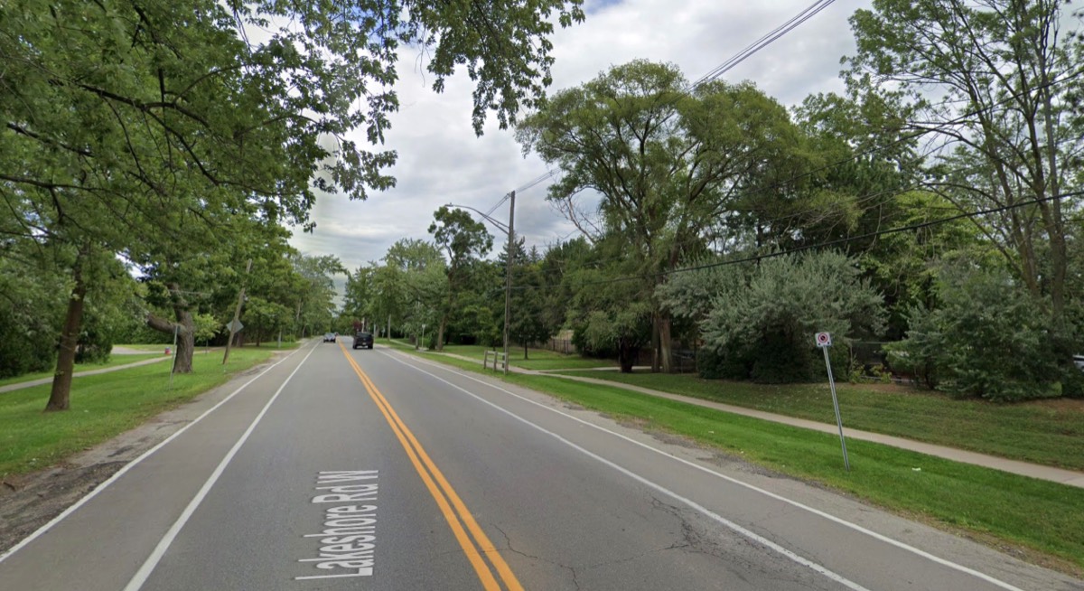
FACT: The current width of Lakeshore can accommodate cycle lanes. Sidewalks already exist on the South side along the entire project route.
Repaving the road and adding bike lanes would provide the needed areas for cyclists. In fact, they already exist between Bronte Village and Third Line.
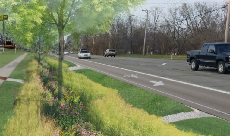
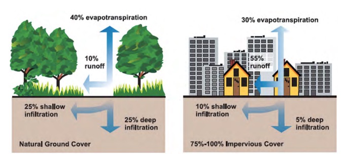
FACT: We can retain a rural road profile using innovative green infrastructure for stormwater.
Today's green infrastructure approaches in stormwater control don't depend on below ground cement pipes, gutters, grit separators and other 'grey infrastructure' solutions that represent 'yesterday's answers'.
We must look for ways to incorporate our existing natural assets with new developments in green infrastructure like those pictured above.
Climate change demands a new way of dealing with stormwater.
FACT: Council Directed Staff to Find a No-Loss Solution
In August of 2018 Town Council voted unanimously on the following motion:
That staff be directed to complete additional consultation on the Lakeshore Road West Improvements (Mississauga Street to Dorval Drive) Class Environmental Assessment and report back to Council in early 2019 with recommendations that include:
- at least one option reflecting no continuous centre lane, no loss of trees and no expropriation of property, while maintaining cycle lanes and reflecting sidewalks/multiuse paths on at least one side and minimizing impervious surfaces.
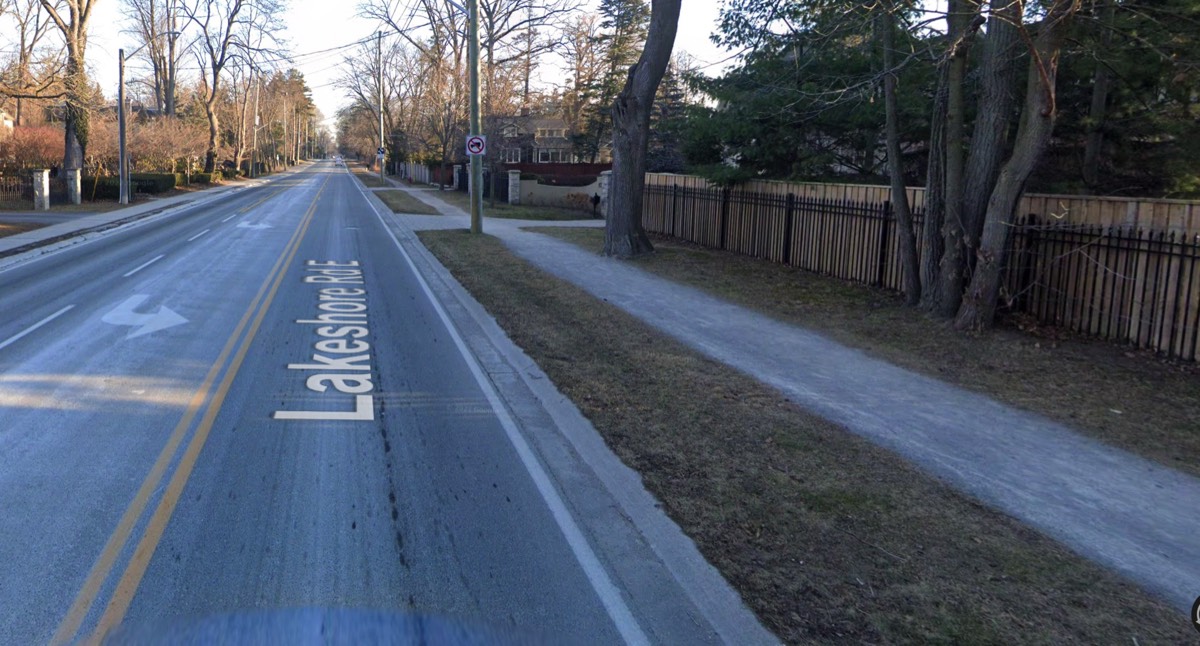
FACT: On Lakeshore Road EAST, Staff Met Directly With Residents and Councillors.
They planned the path together. Note the differences!
◦ The path is 2m wide
◦ Two trees were removed due to failing health.
◦ An arborist would be on site during work.
◦ The path would move to the north side in some areas due to the fact there were hydro poles that would need to be moved and trees that would be damaged/cut down. Cost and appearance were both factors in making this decision.
◦ Staff offered that not all areas along Lakeshore would get a path due to sidewalk by-laws, space restrictions and the fact that tearing up what existed to replace it with a thin strip of asphalt would not be a good use of taxpayers' money.
Why have residents of Lakeshore Road WEST not been granted the same discussions and considerations?
The solutions used on Lakeshore Road East directly mirror what residents in the West have been saying for years.

FACT: THE CLASS ENVIRONMENTAL ASSESSMENT PROCESS CARRIED ON FOR YEARS WHEN NOT REQUIRED.
In July 2021, staff disclosed the following: The removal of the continuous centre left turn lane meant the Class Environmental Assessment process was no longer a requirement, but continued with the EA process since it provided a forum for extensive public consultation.
Staff had never notified residents or Council of this fact. The Town of Oakville had continued to refer to the Lakeshore Road West project as an CLASS EA project in all its communications, written materials and in directions to residents when outlining continued necessary steps to be undertaken in the process. As well, it continued to engage the consultant hired for the EA process and provide staff with more funds was requested in annual budgets under the umbrella of "additional activities that would be carried out under the EA process.

FACT: 5-Million Budgeted in 2022 Alone
While no actual construction has taken place, the costs for this project continue to accumulate.
In 2018 the estimated capital cost of the preferred design concept was approximately $31,665,000 exclusive of land and utility relocation costs.
In 2020, we reported the estimated cost for the overall project would surpass $50-Million
In 2022, we have no idea what has been spent to date, but we do know yet another $5.08-Million was approved for the coming year and all but $25,000 is for outside services.
Timeline of the Project 2018 - Present
Click on the bars below to view details on each time segment. The last bar provides an overview of the current 2022 Request For Proposal document issued by the Town in late summer as well as other facts or details we feel are pertinent.
Let's preserve our heritage and use innovation to achieve it.
Recognize Climate Change
- We must assess the entire project through a Climate Emergency Screening Tool. Cutting down trees for the sake of an asphalt path is not acceptable. Adding more grey stormwater infrastructure is short-sighted.
- The urban profile of Lakeshore Road West allows rainwater to be absorbed by soil, trees, shrubs and roadside ditches. Creating curbs, catch basins and additional grey infrastructure results in an increase of dirty stormwater runoff being directed into pipes faster, thus increasing runoff and the pollution that enters Lake Ontario. We have a choice! We don't have to take this approach.
A Bespoke Solution
- We have continually asked for the use of context sensitive design in creating the renewal of Lakeshore Road West.
- We need to work within the historic context of the road with its mature trees, quaint rural feel and natural drainage features.
- Lakeshore Road is a Scenic Corridor. Let's respect its significance.

Work With What We Have and Enhance It.
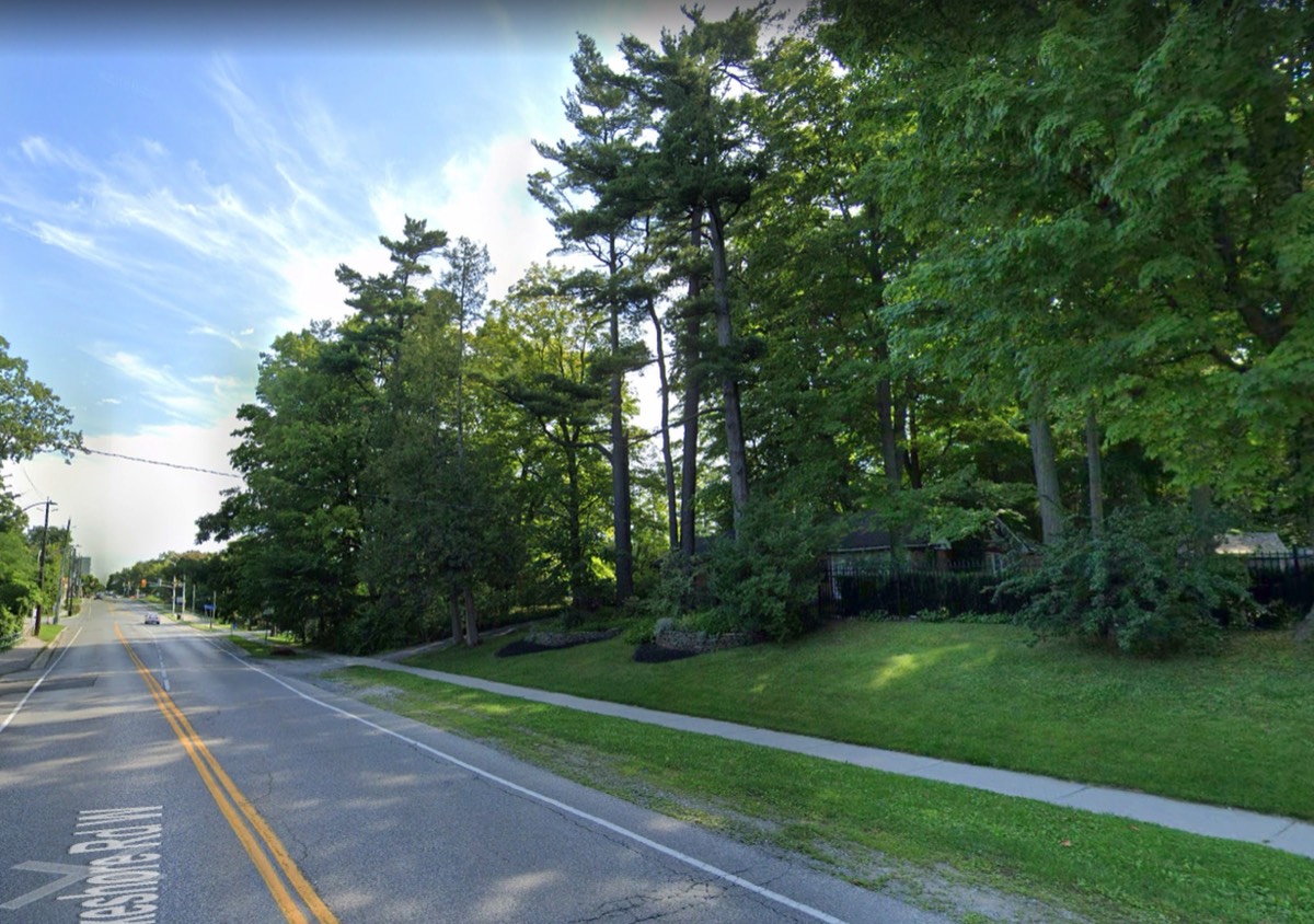
- As this photo demonstrated, the road in its current geography can accommodate bike lanes without disturbing trees.
- Plentiful opportunities exist to enhance our natural green assets for stormwater controls and combine them with innovative advances in hybrid green/blue infrastructure solutions.
- Today's leading municipalities are using green and blue stormwater control methods. We have open ditches, remnant channels and streams we can restore and use in conjunction with new, hybrid stormwater infrastructure.

We Can Deliver Active Transportation With What Exists
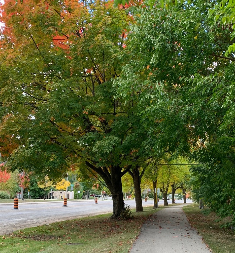
◦ The sidewalks are in good condition and are set well back from the road, offering pedestrians a safe, scenic place to walk and enjoy the surroundings.
◦ The existing paved path on the north side can be extended in some places. Both meet AODA standards and the path is identified on Town maps as being part of the Waterfront Trail.
Frequently Asked Questions
-
What Is the Position of Coronation Park RA?1. No Multi-Use Path
The path is the biggest factor in the loss of almost 100 trees. Many are large, old-growth specimens that not only create part of the outstanding rural beauty and character of Lakeshore Road West, but also act as important partners in controlling storm water, giving shade, and cleaning the environment.
By adding cycle lanes to the areas that don't currently have them, we will be addressing the needs of those who either currently ride on Lakeshore Road or those who would like to cycle on-road but don't feel they can without a cycle lane.
That leaves us with children who want to cycle, pedestrians who wish to walk or jog along route, families out for a walk, dog walkers, those with disabilities who would use a wheelchair or cane who wish to enjoy time outside for a walk. Connectivity for pedestrians and those who wish to use Lakeshore Road for recreation already exists and can be improved.- There is an existing sidewalk on the south side of Lakeshore from East St. to Dorval. If any area is identified as one that requires maintenance or repair, let's fix it.
- There is an existing multi-use path on the north side in every area with these exceptions: Solingate to Third Line, Spring Garden to Westdale, Fourth Line to Whittington Place, Suffolk to Morden.
Solution: Let’s utilize what we already have. Fill the gaps where possible, enhance the path that exists and encourage sharing of our spaces. Those who walk and those who want to pedal or ride can share safely. Let's remember: In Oakville, children under the age of 11 years old, with wheel diameters that do not exceed 51 centimetres or 20 inches and the parent, guardian or other adult who accompanies them are permitted to ride a bicycle on the sidewalk.
2. Preserve Our Tree Canopy. Every Tree Matters.
The Town of Oakville's Tree Policy notes the following:- The Corporation of the Town of Oakville is committed to preserve and enhance its tree canopy and natural vegetation.
- The town shall protect trees on both public and private lands pursuant to applicable by-laws, recognizing their importance to the ecology, aesthetics, culture, and heritage of the town.
- Trees on public lands shall be removed only to safeguard public safety.
3. Protect our Heritage - Significance of Lakeshore Road
The earliest section of Lakeshore Road runs from Great Lakes Boulevard to Fourth Line and was originally part of an Indigenous trail used by the Mississaugas that winds along the lakeshore towards Hamilton. The second section from Fourth Line to Winston Churchill Boulevard follows a straight east west concession road, originally laid out as part of the 1806 Wilmot Survey.
The origins of these two sections of Lakeshore Road still define much of their character and arrangement today. As well, Lakeshore Road was one of the original Kings Highways introduced in 1917.
Oakville's Official Plan, Livable Oakville - identifies Lakeshore Road as a Scenic Corridor under its Urban Structure. Such scenic corridors are defined as “a thoroughfare containing roads and associated features that are recognized for their scenic value and for their related natural and cultural heritage features.”
The Livable Oakville Plan has additional policies that relate to Scenic Corridors. It also added policy 3.14: “Scenic Corridors are recognized for their scenic value and for their natural and cultural heritage features. These important features need to be maintained or restored since they add value and contribute to the Town’s character.” [where “Character means the collective qualities and characteristics that distinguish a particular area or neighbourhood”.]
This policy further supports the existing heritage conservation policies in Livable Oakville Plan (Section 5) and in the case of Lakeshore Road, Policy 5.3.10 states: “The scenic character of Lakeshore Road should be conserved.”
4. Uphold Our Commitment to Fight Climate Change
Town Biodiversity Strategy 2018- Preventing further loss of existing trees is the best way to increase Oakville’s canopy cover.
- Protecting street trees will allow canopy cover to increase.
- Use low impact development for a green streetscape
Climate Emergency 2019 - Oakville Town Council passed a motion declaring a climate emergency in Oakville. Trees absorb greenhouse gases like carbon from the atmosphere. One mature tree can absorb 48 pounds of carbon every year. Trees can reduce the impact of severe flooding and storms. They absorb the extra water in the soil as it surges on land and release it into the air as vapour.
If conservation of our heritage and preservation of our tree canopy are indeed of the utmost importance to Oakville, Lakeshore Road should be be preserved.
5. No Full Urbanization of the Road
We favour the addition of bike lanes, however we do not support other urbanization aspects.
Here’s why- The directions of the Scenic Corridor study should be the lens with which we view any proposed improvements or changes to Lakeshore Road. Its preservation as a place of natural and cultural heritage is paramount to retaining its character and importance.
- Green infrastructure, not gray, should be Oakville’s focus as it moves forward in its fight against climate change. Lakeshore Road is surrounded by a natural network of open ditches, channels, streams, creeks and swales that have formed the minor stormwater system for decades, if not centuries.
- Traffic studies undertaken and sited in the EA study reveal Lakeshore Road, in its present state, has no lack of capability to handle volume, no intersections that do not function at an acceptable level and no glaring safety issues. As such, we support looking at each individual location where improvements are sought in order to determine solutions that are best suited to the road, its character and heritage.
6. Fiscal Responsibility
The project as currently proposed carries a projected cost of over $40.5 Million. That figure does not include the cost to undertake the Bronte Village road improvements. Nor does it include the cost of relocating utilities or the cost of acquiring land. When factoring in the above, the cost of this project as proposed would far exceed $50-Million.
The inclusion of needless features such as a multi-use path that will remove over 90 trees and be replaced by an impervious layer, the use of gray infrastructure when a network of natural assets already exists are examples of unnecessary spending. -
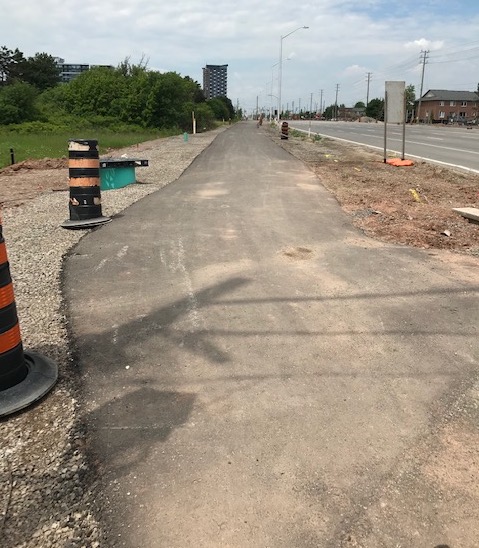
How Would the Town's Proposed Multi-Use Path Look?The multi-use path being proposed on the south side of Lakeshore would be 3m wide. To put that in perspective, 3m is slightly under the width of a single road traffic lane.
It is to be positioned immediately adjacent to the road and it is the sole reason why trees would be cut down.
Photo 1 below shows the multi-use path constructed on the north side of Rebecca St. just west of Mississaga Street in Bronte. This is what we could expect to see if such a path is put in place along Lakeshore Road West.
Photo 2 below shows an area on Lakeshore just east of Bronte Village as it currently exists. The sidewalk, that is in good condition, would be removed and a new sidewalk would be constructed alongside the multi-use path. Every tree in this photo on the right side of the frame would be cut down in order to accommodate the path that will look like the one in the first photo.Photo 1.
A multi-use path already constructed on Rebecca St.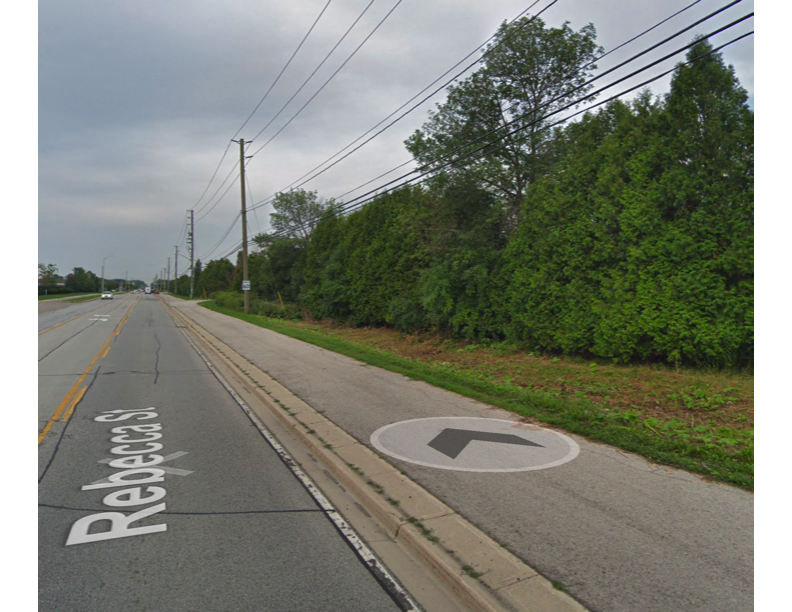 Photo 2.
Lakeshore Road West as it currently exists.
SPECIAL NOTE: This photo shows that bike lanes are already in place in this area of Lakeshore Road West. You can see the present 'road deck' is wide enough to accommodate bike lanes without having to harm the areas bordering the road.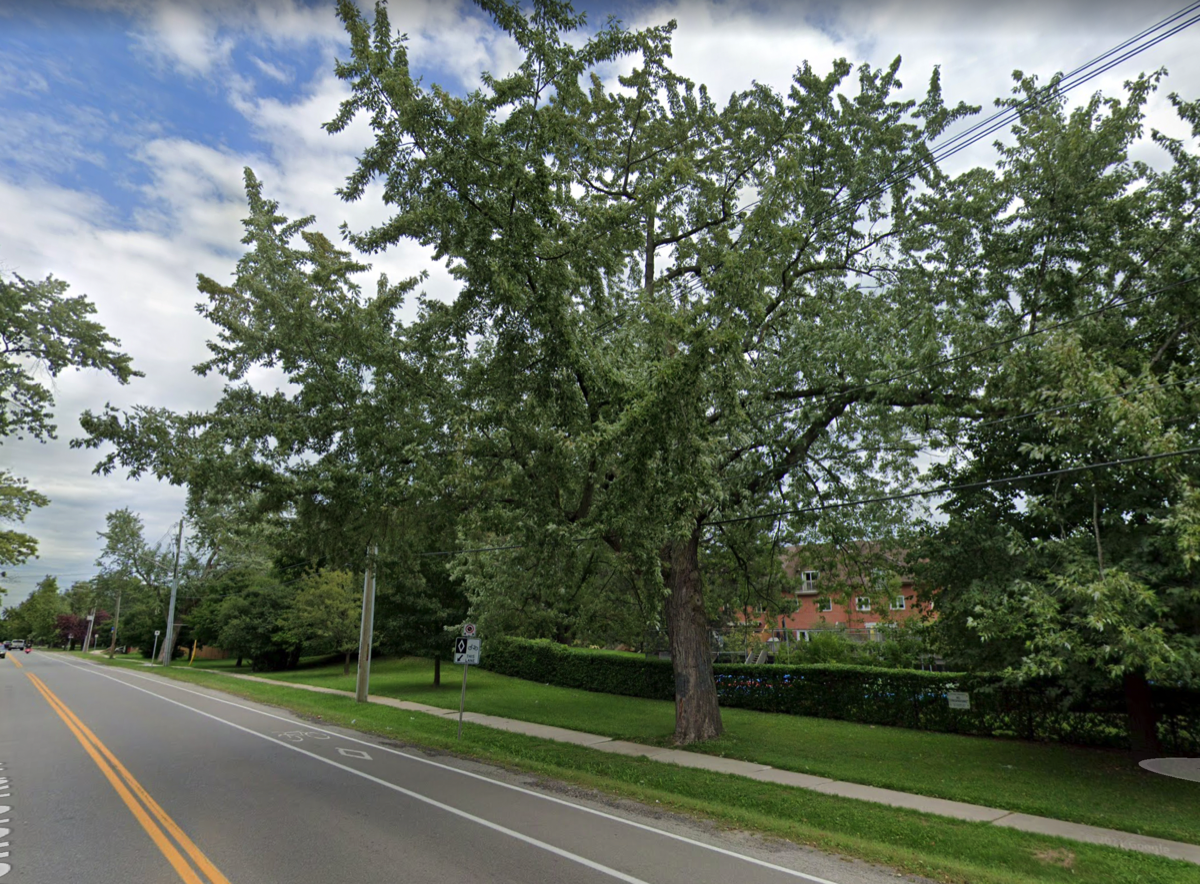
-
Could We Save the Trees Using the Proposed 3m Path?In the communications from the Town, it has been stated that "the town will look for opportunities to further mitigate tree impacts by narrowing the sidewalk or trail, or by curving the sidewalk or trail around trees where possible".
In actual fact, to construct a 3m wide multi-use path, it takes at least 5m to do so.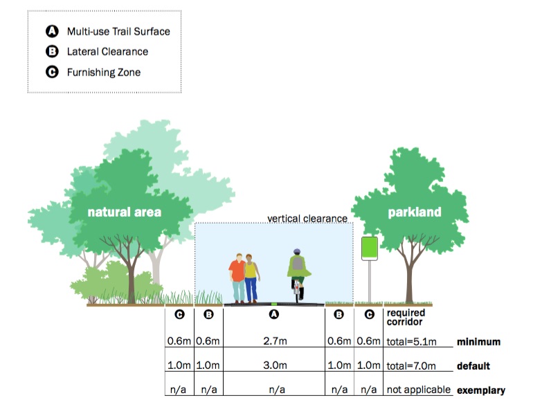 The image depicting the root system of a tree below shows us that the roots, which spread out from the tree are crucial to its health and survival. They can be very near the surface - even only 3-5" below.
We should not be willing to sacrifice trees for the sake of an asphalt path.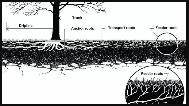 The damage caused by the construction of the path is evident in the photos below. It is painfully obvious from these images that no 3m path will curve around a tree and simply narrowing it does not prevent the kind of destruction caused by the construction required.
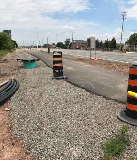
-
What Is Green Infrastructure?Basically, Green Infrastructure filters and absorbs stormwater where it falls. A definition of Green Infrastructure: "the range of measures that use plant or soil systems, permeable pavement or other permeable surfaces or substrates, stormwater harvest and reuse, or landscaping to store, infiltrate, or evapotranspirate stormwater and reduce flows to sewer systems or to surface waters." By reducing rainwater flows into sewer systems, green infrastructure can reduce pumping and treatment demands for municipalities.
Gray Infrastructure means structural control practices to control stormwater discharges. Gray infrastructure is traditional stormwater infrastructure in the built environment such as gutters, drains, pipes, and retention basins. Examples of Gray Infrastructure include tunnel systems, storage tanks, in-line storage facilities, sewer lines, and high rate clarification treatment facilities.
Currently, Lakeshore Road W has a Rural cross-section with open ditches (swales), natural soil shoulders, abundant greenery including grass, bushes, trees, etc. A great majority of the stormwater that falls during a rain or storm event is absorbed by these natural features. Water runs off the road and is soaked up by the surrounding soil, bushes, trees, etc. Tree roots that fortify the soil help to prevent erosion. Along our streets, the roadside ditches capture the runoff from our streets and homes. As the water is carried away, it is filtered by the ditch and the pace of its movement toward Lake Ontario is slowed. It is doing a great job as Green Infrastructure!
Urbanized roads have cross sections that typically include curbs, gutters, catch basins and underground storm water services including grit separators.
The addition of elements such as curbs, gutters, man-made stormwater controls (known as gray infrastructure) to a rural road cross-section causes considerable impact, visually and environmentally. Adding curbs/gutters, means rainwater from Lakeshore that currently falls and is absorbed by roadside ditches, trees and vegetation would run off the road into gutters and be directed to pipes below the road surface.
The Result:
increased runoff
increased contaminants
increased water into Lake Ontario
decreased quality of that water.
With gray infrastructure, stormwater may travel long ways over impermeable surfaces before it reaches a river, lake or sea – by which time it has picked up untold pollutants, toxins and nasty critters (like E. coli, harmful to both humans and animals).
Often, when gray infrastructure gives water nowhere natural to go, that water has no choice but to head toward a destination that can’t handle the volume, such as sewers, which then overflow and poison the environment.
There are already a number of areas along Lakeshore Road West and nearby streets that use gray infrastructure. We don't want to increase it - we want to enhance/restore the green infrastructure we have to lessen the effects and costs of grey infrastructure. We want our systems to be more natural, as they are the systems that create sustainability.
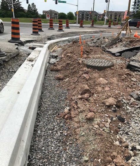
Any additional infrastructure that is required to handle our local stormwater should be natural where possible and green if required as new. The vast amount of what the Town of Oakville is proposing represents Gray Infrastructure. It means the introduction of curbs, gutters, Below are images of curb construction. It's easy to see how much of the roadside is destroyed in undertaking this work. Trees that are near the road, such as those located at the intersection of Third and Fourth Line, for instance, will be the victims of curbs if we allow the proposed form of gray infrastructure to be used.
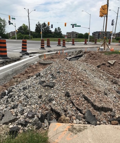
Come Walk With Us
Come with us as we walk along a small portion of the route and as you do, think of the destruction that would be caused if we lose these trees to an asphalt path and roads widened to accommodate curbs and gutters. It doesn't have to happen. There are green solutions for stormwater that don't require yesterday's concrete, gutters and grit separators.
Click on the images below to start each presentation.
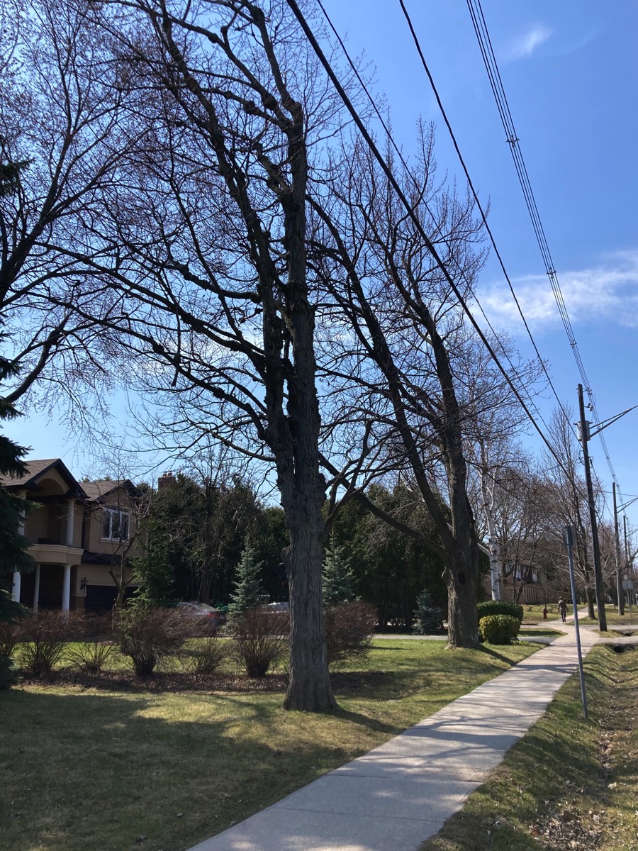

Walk With Us - Solingate to Third Line
Part One takes us from Solingate to Third Line.
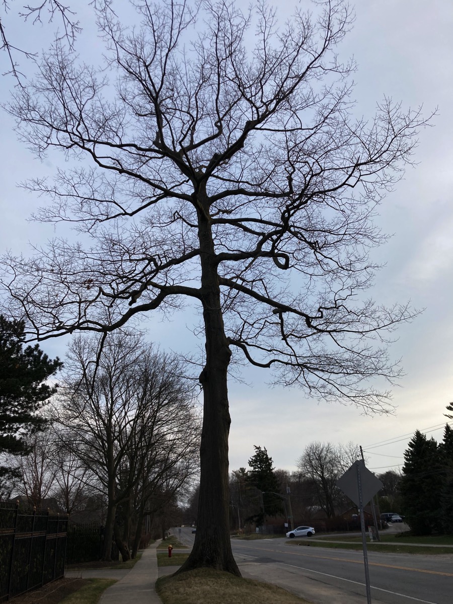
Total number of trees lost in this section is 37, starting with this beauty at the corner of Third Line and Lakeshore, and each of the trees on the remaining 3 corners of the intersection.
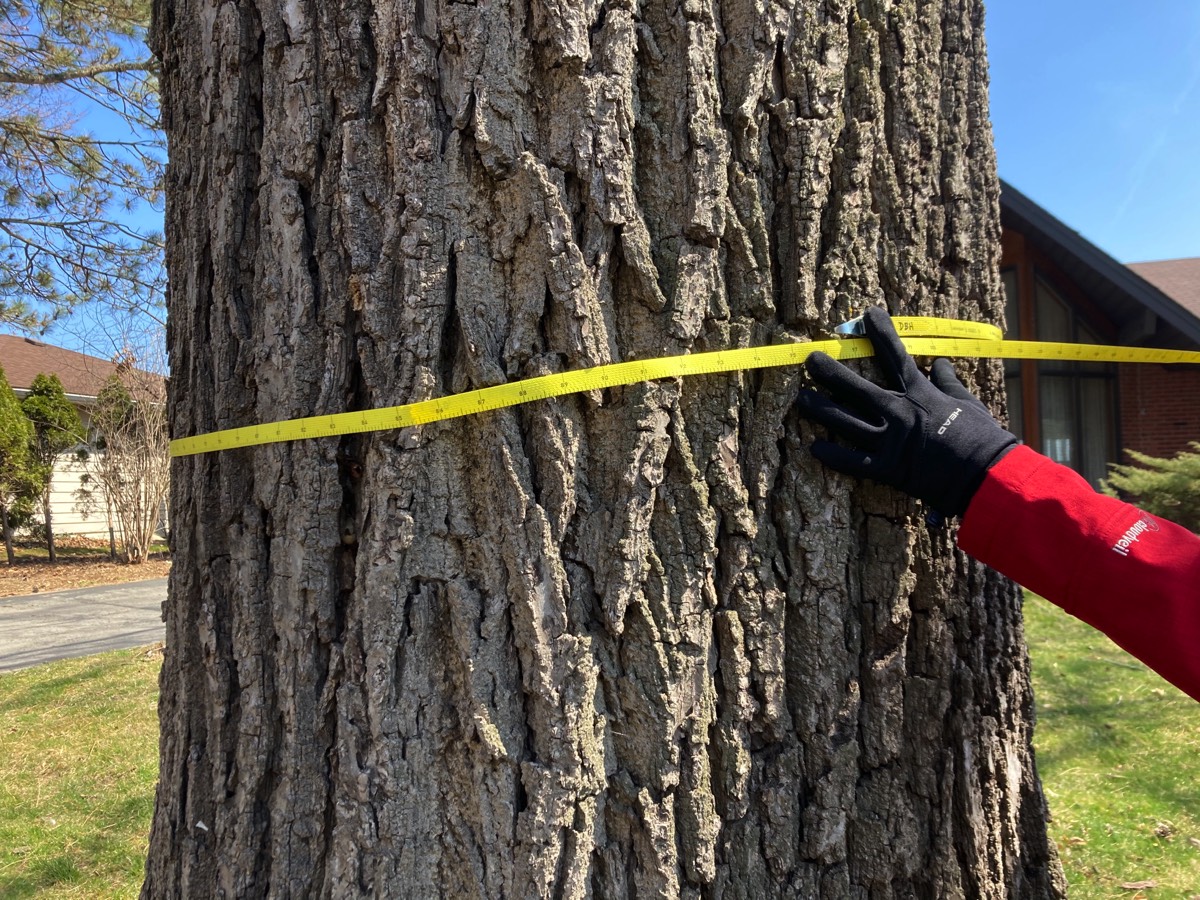
Every one of these images features a tree or trees that will be cut down. In the words of Karen Brock, Oakvillegreen President … 19 very large trees in a row, south side of Lakeshore, starting at Third Line, heading west - all slated for removal.
Mostly silver maples, one measuring 107cm diameter!! Some have had to compete with the hydro wires, but still have a canopy that will be missed!
The hard work and generosity of Oakvillegreen Conservation Association allows us to share these images. Our sincere thanks to Karen Brock, President for locating the trees and providing these images.
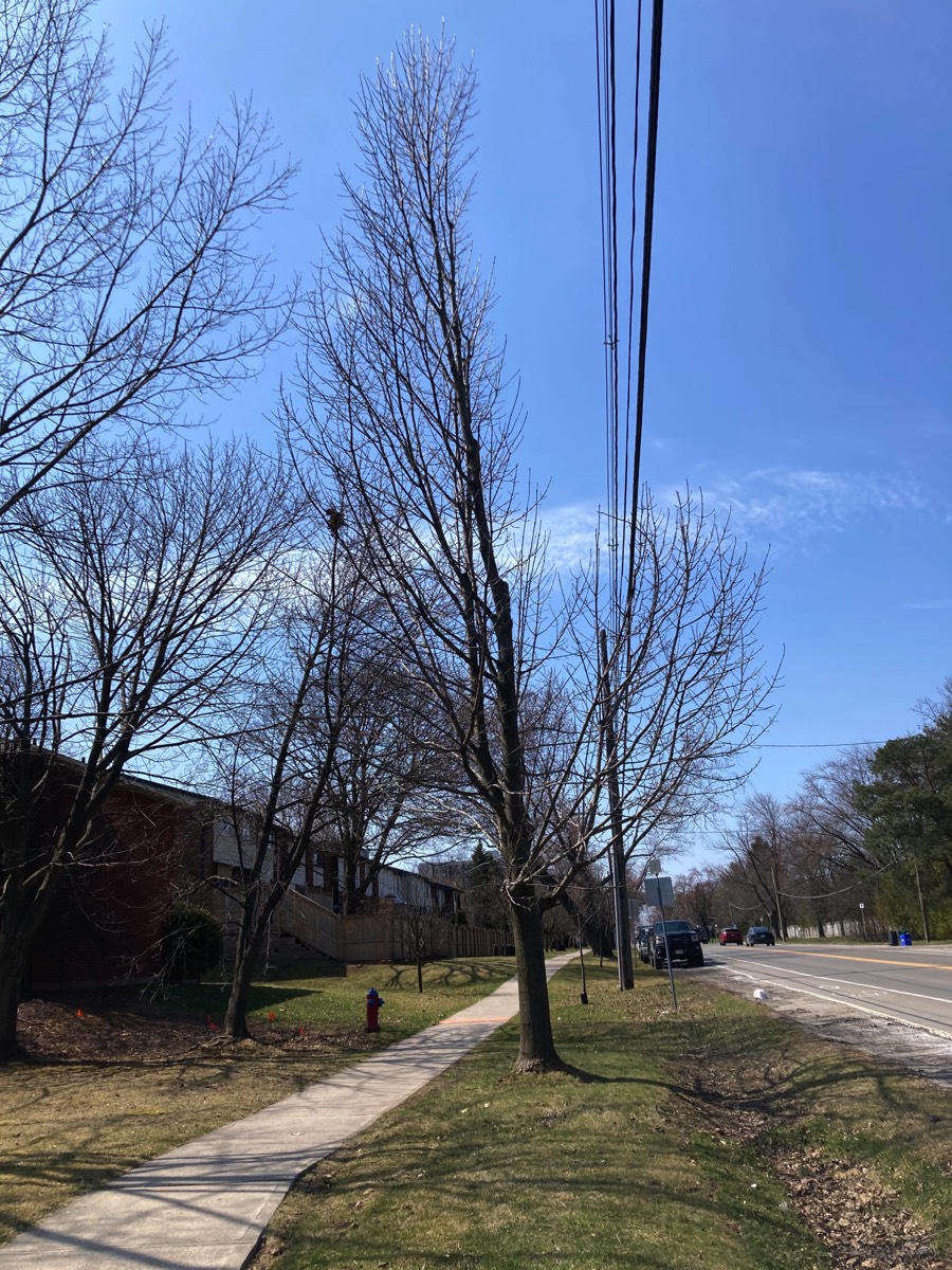
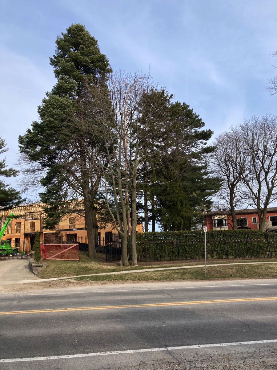
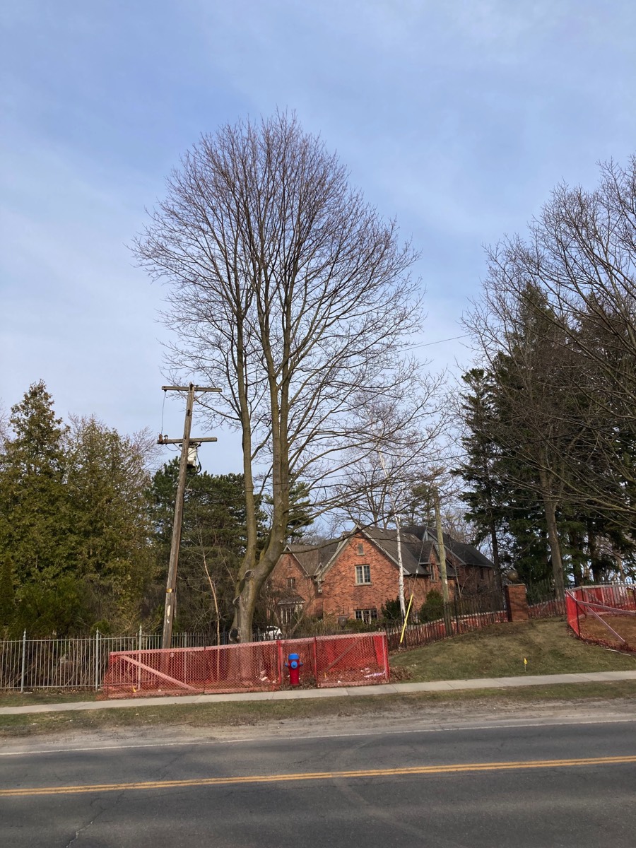
Walk With Us - Third Line to Woodhaven
Once again, these include large, old growth trees that help create the canopy over Lakeshore.
You'll also see a line of trees - newly planted by the Town just a few years ago - that are also marked for removal!
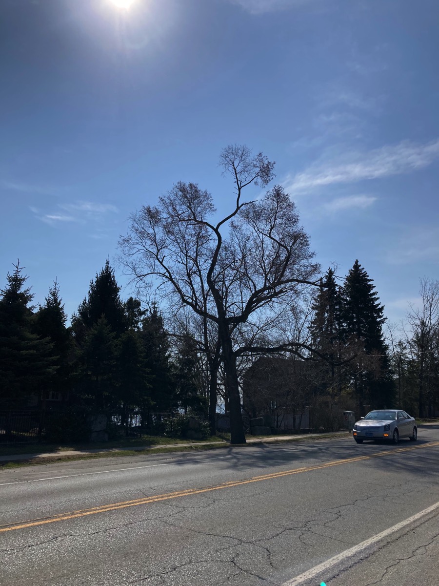
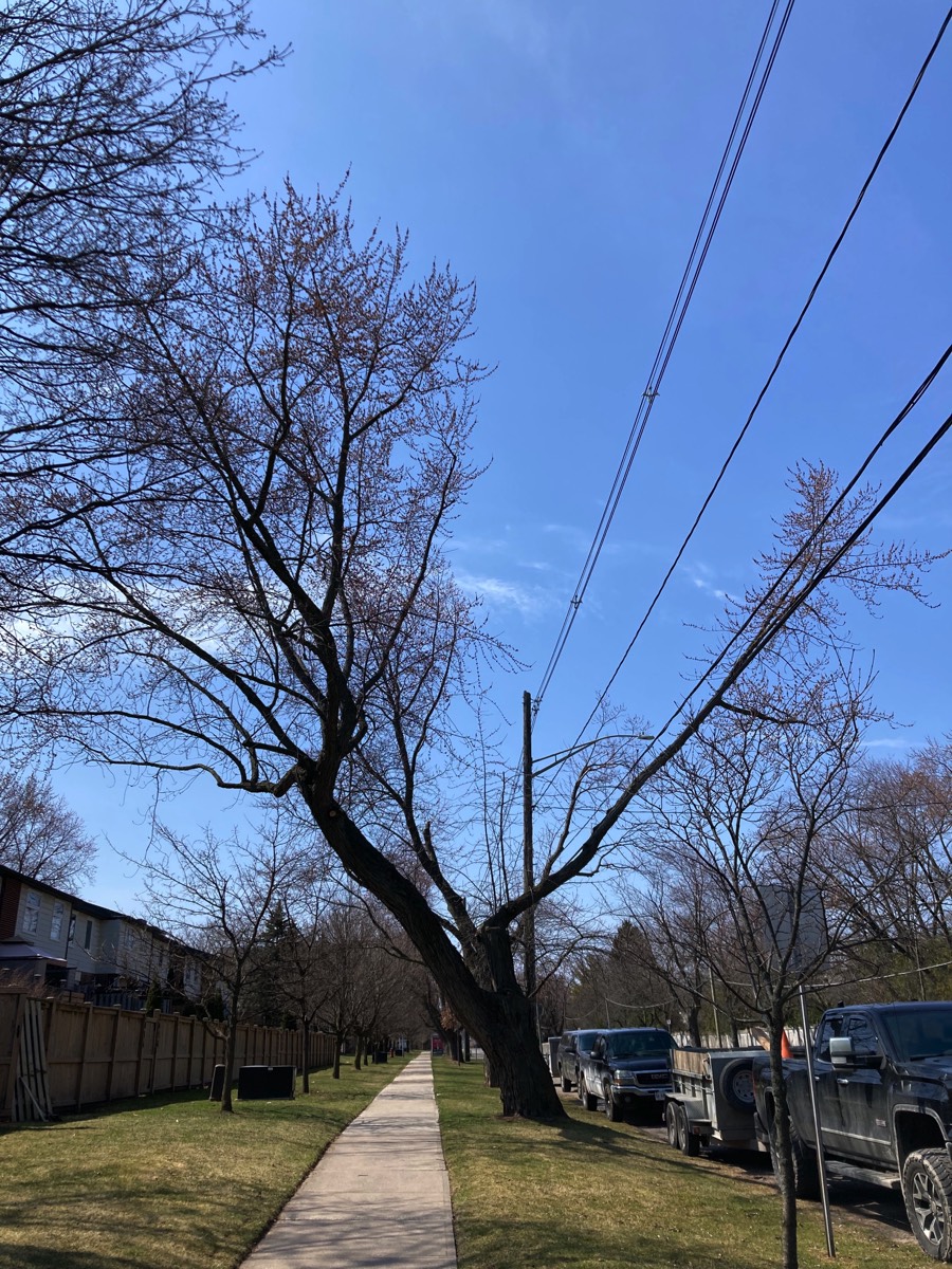
Walk With Us - Woodhaven to Wolfdale
We had never received a response to the letter we filed with the team in December 2017.
Lakeshore Road in its present 2-lane configuration can function at an acceptable service level to 2031 and beyond, traffic forecasts show levels dropping in future, not increasing and safety records indicate 54% of the collisions occurring are in the Village of Bronte, not on the remainder of the corridor. The plan in its present form cannot be supported. It will destroy the character of Lakeshore Road West.
VIEW THE PRESENTATION IN PDF FORMAT
Read the Staff Report. See a copy of our presentation to Council.
- That staff be directed to complete additional consultation on the Lakeshore Road West Improvements (Mississauga Street to Dorval Drive) Class Environmental Assessment and report back to Council in early 2019 with recommendations that include at least one option reflecting no continuous centre lane, no loss of trees and no expropriation of property, while maintaining cycle lanes and reflecting sidewalks/multiuse paths on at least one side and minimizing impervious surfaces.
Lakeshore Road’s character is not determined by one single factor, such as mature trees. It is a composite that includes structure, topography, vegetation and overall visual character of the road right-of-way and immediate abutting lands. This character includes ragged road edges, mixtures of bushes and trees, a roadway that meanders slightly, old bridges, creeks, open ditches, etc. While this is considered an urban road, it possesses many rural attributes that are an integral part of its character.
What We Desire:
• to conserve and protect the road’s special character, biodiversity and native habitats, cultural heritage resources, recreational opportunities and sense of place.
• to recognize and protect the specific history and visual or natural character of the road and its roadside features.
• to ensure that changes are limited to only those that are absolutely necessary and when undertaken, those changes respect context sensitive design.
Read the full submission here.
See the entire staff report here
Along with other residents, CPRA delegated in an online Council session in July 2021 to oppose the "Preferred Alternative" design. The information included the fact that when the Class Environmental Assessment was released on-line, residents were able to provide comments on the proposal. There were 194 responses. More than 50% specifically opposed the plan and removal of trees, whilst only 18% supported it.
It was at this meeting that staff announced it could not meet the 2018 Motion from Council to present an option that would represent no loss of trees, AND it announced the fact that the EA process has been unnecessary after the centre lane was removed from the plan …. AND YET, it continued to engage and pay the consultant for the past three years!
Yet another motion from Council came forth as detailed in the Timeline section above.
All fell quiet until 15 months later…
For the period of some 15 months between Council's July 21 Motion and the time of issuing the RFP, no contact, conversations or meetings were undertaken with residents.
Stay tuned for updates.